Maps Unique Offshore GPS Products

Maps Unique is the ultimate offshore information tool mapping the nearshore and offshore waters of NC, SC, and Georgia. Our printed maps and GPS products geographically depict the most productive natural habitats and provide descriptions and data about those habitats. The Maps Unique series, first published in 1988, provides over 35 years of continued research and development.

May all your offshore travels be a blessing!
Capt. Chip Berry,  Product Originator/Owner

Select A Pin To Left To View Map Area!

  • Hatteras/Cape Lookout – Oregan Inlet thru Swansboro
  • Cape Lookout/Cape Fear – Morehead City thru Carolina Beach
  • Murrells Inlet/Charleston – Southport thru Charleston
  • Savannah GA/Beaufort SC – South Edisto thru St. Simon Island, GA

Select Below or On Top Tool Bar For Other Products

Printed Maps

Maps Unique Fishing Maps

``Nav-Unique`` SD Cards For Your GPS

GPS Digital Computer Products

``Seamarks`` Computer Software

Maps Unique

``Art Unique`` - Blue Marlin Series

Maps Unique Printed Art

Podcast

Maps Unique Podcast

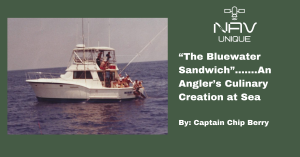
“The Bluewater Sandwich”…….An Angler’s Culinary Creation at Sea

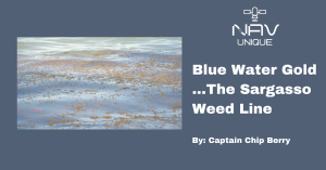
Blue Water Gold…..The Sargasso Weed Line

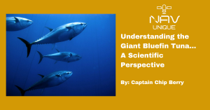
Understanding the Giant Bluefin Tuna…A Scientific Perspective

Subscribe To Our Newsletter


This will close in 20 seconds